
COURSE NARRATIVE and HISTORY
Ironstone 100K Course Summary
What is it like to run Ironstone 100K?
First, 3 miles of well-groomed, rolling state park trails (don’t get too comfortable).
Then, 17 miles of flat, unshaded, hard-packed rail trail—fast, but it’ll cook you.
Next, 40 miles of rocky, one of the most technical ridgeline running in Pennsylvania with sections that are barely runnable. Toss in 4 climbs that stack up to 8,000 feet of gain.
Final 3 miles? A steep, winding plunge downhill—because why not.
Our “best” year ever? 61% of starters made it to the finish.
Ironstone 100K Detailed Course Description

Historic Blair Limestone Company Kilns at Canoe Creek State Park
Section 1: Canoe Creek State Park - Mile 0 to 4.7
4.7 miles.| 561 feet climb; 564 feet decline
3.5 miles of trail; 0.9 paved road or trail; 0.2 crushed stone
Runners start in the open field between Pavilion 2 and the lake, heading north on Limestone Trail past historic kilns. The route follows Hartman Trail up Moore’s Hill, passing caves on the right—home to the endangered Indiana bat—with views of Scotch Valley to the west. A descent down Moore’s Hill Trail leads to a Canoe Creek crossing, then south on Beaver Pond Trail back toward the lake.
Familiar with the Dirty Kiln Trail Race? You’ll recognize some sections here. After passing through the East Shore Day Use Area, runners take a left onto a service road, then a right onto paved Beaver Dam Road. The course continues on the Canoe Creek Connector Trail, passing under Route 22 via the Terry Wertz Memorial Underpass. It follows Route 22 to Flowing Springs Road, crossing the Frankstown Branch of the Juniata River before reaching Flowing Springs Station, the first aid stop near the Lower Trail.
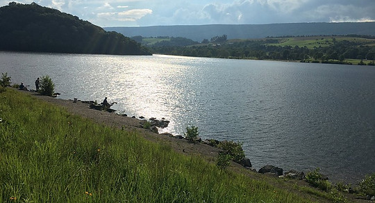
Canoe Creek Lake
History and Wildlife
Canoe Creek State Park sits atop rich limestone deposits that once fueled Pennsylvania’s iron and steel industries. Abandoned quarries and two lime kilns from the 1900s remain as reminders of this industrial past. Runners will pass two kiln sites, including remnants of the Blair Limestone Company’s operation.
The Frank Felbaum Bat Sanctuary at Canoe Creek State Park is home to Pennsylvania’s largest nursery colony of little brown bats. Visitors gather at dusk to witness thousands of bats emerging from the former church-turned-Canoe Creek Bat Refuge. The park also shelters a hibernaculum where six bat species, including the endangered Indiana bat, seek winter refuge.
At Mile 1, at the top of Moore’s Hill, you’ll spot abandoned mine entrances on the right—once home to 30,000 bats before White-nose Syndrome devastated populations in 2008. By 2009, the disease had wiped out nearly all local cave bats, leaving only 71 survivors. Today, the site shows signs of recovery, with a growing population of around 1,000 bats.
At this same mile marker, you’ll also see Brush Mountain on your left, once protected as The Nature Conservancy’s Brush Mountain Preserve until October 2024. This vast oak-hickory forest was considered one of the world's most biologically diverse temperate broadleaf forests. Now managed by the PA Game Commission, it remains both a County Natural Heritage Area and a Landscape Conservation Area, preserving its ecological importance in the Central Appalachian landscape. The Brush Mountain Ridge is popular with soaring birds and glider pilots ridge soaring along its slopes. This ridge is part of a chain of ridges that stretch south to Tennessee.
At mile 3.9, runners will cross under U.S. Route 22 at the Terry Wertz Memorial Underpass. Running parallel to the Frankstown Branch of the Juniata River between Mount Union and Hollidaysburg, US 22 has long been a key transportation corridor linking the Susquehanna River in the east to the Ohio River in the west.
First cleared as a wagon route in 1789, the road quickly became a major avenue for transporting iron from the Juniata region to Pittsburgh. Improvements funded in 1807 led to its designation as the Huntingdon Pike. By 1821, it was further developed into the Huntingdon, Cambria, and Indiana Turnpike, also known as the Northern Pike, reinforcing its role as a critical trade and travel route through Pennsylvania’s rugged interior.

Lower Trail (pronounced like "Flower") is a 17-mile multi-use raiils-to-trail which Ironstone participants will run from end to end. The Lower Trail is now a part of the September 11th National Memorial Trail.
Section 2: Lower Trail to Williamsburg Station - Mile 4.7 to 9.75
5.1 miles | 0 feet climb; 36 feet decline
5.1 miles of paved trail or crushed stone
Runners will continue on the Lower Trail (pronounced like: "flower"), a 17-mile crushed limestone rail-trail. (Bonus points if anyone can count the fence posts along the "Never-ending Fence"!) The next stop is AS 2 Williamsburg Station, a crew-accessible aid station in the borough of Williamsburg.
Think a gentle downhill grade makes for easy running? Think again! Hours on crushed limestone present a unique challenge—how you train will make all the difference. As Chris Traeger might say, “Ended with a 5 1/2-minute mile, my personal low. I think the pavement in this town is soft.”
.jpg)
At 7.6 miles on the course, runners will reach a bridge crossing over Piney Creek. This used to be Springfield Junction at the village of Franklin Forge. The village would then change to Gannister. On both sides of the river were iron ore and limestone quarries.
History: A Pathway of Old and New
The Lower Trail follows the Frankstown Branch of the Juniata River and was once part of the Petersburg Branch of the Pennsylvania Railroad. After its abandonment in 1979, the rails were removed, and the corridor was sold off. In 1989, Rails to Trails of Central PA purchased the first 11 miles, extending it by another 5.5 miles in 2004.
In 2022, the Lower Trail became part of the September 11th National Memorial Trail, a 1,300-mile network linking the Flight 93 National Memorial, the Pentagon Memorial, and the National September 11 Memorial & Museum.
The first four aid stations on the Ironstone 100K are called "stations"—a tribute to the train stops that once lined this historic route.
Today, the Pittsburgh-to-Harrisburg Main Line Canal Greenway isn’t a single long-distance trail but a network of land and water trails that let visitors experience its landscape, communities, and rich history.
The Frankstown Branch of the Juniata River, part of the upper Juniata, has been named a Pennsylvania River of the Year for its ecological and recreational significance. Recognized as a Chesapeake Bay Gateway by the National Park Service, the Upper and Lower Juniata River Water Trails have also earned the designation of National Recreation Trails.
The Juniata Water Trail offers more than just paddling—it’s a journey through history, nature, and culture, showcasing key historical sites, diverse wildlife, and the unique ecosystems that make this region so special.

Lower Trail (pronounced like "Flower") is a 17-mile multi-use raiils-to-trail which Ironstone participants will run from end to end. The Lower Trail is now a part of the September 11th National Memorial Trail.
Section 3: Williamsburg to Alfarata Station - Mile 9.75 to 20.8
10.7 miles | 0 feet climb; 126 feet decline
10.7 miles of paved trail or crushed stone
Williamsburg, a designated "trail town" where the Lower Trail and Mid State Trail intersect, offers runners a quick treat—complimentary ice cream from Lower Trail Creamery! Don’t miss out before continuing on the Lower Trail toward AS 3: Mt. Etna Station (Mile 15.6). After refueling, it's another 5.1 miles to the trail’s terminus at AS 4: Alfarata Station.


A canal boat along the Pennsylvania Main Line Canal. A total of 86 locks were required to overcome the change in elevation from Duncanan along the Susquehanna River to Hollidaysburg. One of the remains of these locks can be seen near mile 12 of the course. Look for a short trail on your left.
History: An Important Passageway
The Lower Trail follows the path of the Pennsylvania Main Line Canal’s Juniata Division, which operated in the mid-1800s. Approved in segments starting in 1827, the canal originally stretched 40 miles from Duncan’s Island to Lewistown. It was later extended 127 miles to Hollidaysburg, where it connected to the Allegheny Portage Railroad. To navigate the 584-foot elevation change, the canal required 86 locks. One of these historic locks can still be seen near Mile 12. Prior to the canal, Alfarata and nearby Water Street was the junction of three indian trails, Frankstown Trail which was along the river, Warriors Mark Path to the northwest and Penns Creek Trail to the northeast.
Built in 1809, the Mount Etna Furnace once produced up to 600 tons of pig iron annually, playing a crucial role in Pennsylvania’s early iron industry. Constructed from cut dolomite, the furnace stands 25 feet high and was most productive between 1830 and 1865, employing as many as 130 laborers in a self-sufficient company town of several hundred residents.
Initially, wagons hauled pig iron along the Huntingdon Turnpike to western Pennsylvania markets. But after 1834, the opening of the Main Line Canal and the Allegheny Portage Railroad provided a faster, more economical route to Pittsburgh, where the iron was processed in rolling mills.
During the Civil War, under Samuel Isett’s ownership, the furnace ramped up production to over 1,000 tons per year, contributing to munitions for the war effort. However, as modern furnaces in Pittsburgh became more efficient, Mount Etna shut down in 1876, ending its nearly seven-decade legacy.
The canyon between Mt. Etna Furnace and Alfarata is recognized as an Important Bird Area by the Audubon Society and the Ornithological Technical Committee of the Pennsylvania Biological Survey. This designation highlights its significance in conserving bird populations and overall biodiversity. Keep an eye (and ear) out for a variety of bird species as you run through this ecologically rich corridor!
Not too far are caves, home to a species of Springtails that live nowhere else in the world! Springtails form the largest of the three lineages of modern hexapods that are no longer considered insects.
Alfarata Station was adjacent to the world-famous Brick Works, a huge industrial complex that used the area's fine-grained sandstone for the production of silica bricks.

Benjamin Emmett of Randolph, New Jersey makes it to the top of Spruce Knob and the first major climb on the Mid State Trail section of the Ironstone 100K course. (Mile 25.4)
Section 4: Mid State Trail in Rothrock State Forest to Colerain - Mile 20.8 to 27.7
6.86 miles | 1929 feet climb; 734 feet decline
3.8 miles of singletrack; 2.8 miles of dirt road, 0.25 feet paved road
Leaving AS 4: Alfarata Station, runners cross a paved road and follow Brickyard Road, a dirt state forest road, before turning onto the Mid State Trail (MST) at a switchback. Now on singletrack, the MST descends into a shady hollow, running parallel to the Norfolk Southern railroad before reaching Barre Road and Neubauer Lane (left turn).
From here, runners cross the railroad and pass through the small village of Barre, then cross the Little Juniata River before turning left onto Mountain Road (gravel). After 0.6 miles, the course reaches the MST Barre Trailhead at the Little Juniata Natural Area in Rothrock State Forest.
Now the real climb begins—1.6 miles up 1,400 feet of technical singletrack to the summit of Spruce Knob. Most runners will arrive just before sunset, so don’t miss the breathtaking left-side overlook, one of the most spectacular views in Central PA.
On Tussey Ridge, runners continue 0.8 miles on technical but relatively flat singletrack before descending Rainbow Trail to Colerain Road. Don’t let the name fool you—"Rainbow Trail" is anything but gentle. Steep and covered in scree, this section will likely be tackled in the dark, so we’re renaming it:
☠️ "It’s Not All Sunshine and Rainbows."
At the bottom, a right turn on Colerain Road (uphill) leads to AS 5: Colerain at Canoe Mountain Vista. From here, runners can take in sweeping views of Spruce Creek Valley, Tyrone, and Canoe Mountain—the very ridge hiding Canoe Creek Lake, where this journey began.
This entire section was time-lapsed videotaped during Ironstone 2024 by Nick Drozdiak.
.jpg)
From Spruce Knob on Tussey Mountain, runners are treated to a breathtaking view along the Mid State Trail. This ridge isn’t just a scenic highlight—it’s also a hotspot for soaring birds and glider pilots who take advantage of the strong ridge lift along its slopes.
Part of a ridge system stretching south to Tennessee, Tussey Mountain has been designated a Pennsylvania Important Bird Area. It serves as a key spring raptor migration site and a protected forest corridor, with over 50% of its land publicly owned.
Keep an eye on the sky—you may spot hawks, eagles, and other birds of prey riding the thermals overhead!
Geology and History:
The Little Juniata River is among the oldest rivers in the world, dating back 320–340 million years—older than the mountain ridges it cuts through. This is especially visible at Alfarata and the Little Juniata Natural Area.
These ridges were formed during the Alleghenian orogeny, a massive uplift event when Africa (as part of Gondwana) collided with North America.
The Juniata River, including the Delaware River, the Susquehanna River, the New River, and the Potomac River, are older than the present mountains, having cut water gaps that are perpendicular to hard strata ridges. The region was uplifted slowly enough that the rivers maintained their course, cutting through the ridges as they developed.
In colonial America, the Little Juniata River was a crucial waterway. Freight was loaded onto flat-bottomed boats called "arcs" in Birmingham (east of Tyrone), where shipments awaited high water to navigate the rocky streambed. Therefore, even to this day, the Little Juniata remains a "commercially navigable river".
In Barree, runners will cross a vital transportation corridor—the Pennsylvania Railroad’s (now Norfolk Southern) Mainline. Here, the railroad slices through a tight gap in Tussey Mountain, a crucial passage that shaped regional commerce and travel.
Between Barree and Tyrone, the railroad crosses the Little Juniata River 15 times—requiring more bridges in this 20-mile stretch than in the previous 200 miles of track. Originally established in 1846, this corridor played a key role in connecting Pennsylvania’s industrial hubs.
Recognized for its significance, the Pennsylvania Railroad District was designated a national historic district in 1990, encompassing the Little Juniata River bridges and tunnels. This corridor also preserves nationally significant cultural landmarks, including:
-
The Pennsylvania Railroad, once the world’s largest transportation system
-
The Juniata Division of the Pennsylvania Main Line Canal, a crucial 19th-century waterway
-
The historic districts of Hollidaysburg, Huntingdon, and Alexandria, key industrial and trade centers of their time
Today, this historic artery remains a powerful symbol of Pennsylvania’s transportation and industrial legacy—and runners will quite literally race across history.
.jpg)
Mike Delorso II, makes it to "The Gate" on the Mid State Trail at mile 28 of the course. Ahead is the section we call, "The Ankle Graveyard."
Section 5: Tussey Ridge: The Ankle Graveyard to Tiltrock Tantrum - Mile 27.7 to 36.2
8.9 miles.| 741 feet climb; 1122 feet decline
8.9 miles of singletrack or doubletrack
After AS 5: Colerain, runners return to the Mid State Trail (MST), continuing northbound on Tussey Ridge—and this is where things get real.
The Stone Towers mark the start of the narrows, where the terrain drops off steeply on both sides. At Promontory, runners get a stunning 270-degree panoramic view before tackling even more technical terrain en route to Henry Gap Vista. Look to your left—about 15 yards down—for a bench and stone chairs.
This brutal stretch from Stone Towers to Henry Gap Vista has earned its nickname: ☠️ "The Ankle Graveyard."
If your ankles survive, next up is "Tiltrock Tantrum." Here, massive rock slabs, tilted 30 to 40 degrees, are a dramatic reminder of when Gondwana and Laurasia collided to form the supercontinent Pangaea during the Carboniferous period. ("Angry at the RDs? Don’t blame me, blame plate tectonics!")
After surviving these geological tantrums, runners reach Pennsylvania Furnace Road, where they turn right, downhill. At the first switchback, they veer slightly left onto Pump Station Road for 1.07 miles, before reaching AS 6: Indian Steps, located above Harry Valley Road.
.jpg)
Mike Delorso II on a damp training run at Tiltrock Tantrum. "Don't blame me, blame plate tectonics."
Geology:
Tussey Mountain, stretching 80 miles (130 km) from Flintstone, Maryland, to Tusseyville, PA, is one of the longest named ridges in the Ridge-and-Valley Appalachians. It belongs to the Appalachian Ridge and Valley province, alongside nearby formations like Brush Mountain, Mount Nittany, and Bald Eagle Mountain. These ridges are remnants of a massive Paleozoic anticline shaped by the Appalachian orogeny, consisting of:
-
Ordovician Bald Eagle Formation Sandstone
-
Juniata Formation Shale
-
Silurian Tuscarora Formation Quartzite
When standing atop the ridge, look west and imagine the valley below as the eroded remnant of a once-Himalayan-scale mountain range. The oldest exposed rock layers deep in Spruce Creek/Nittany Valley are all that remain of this ancient giant.
Below, Spruce Creek is a tributary of the Little Juniata River. Spruce Creek passes by Indian Caverns several miles before joining the Little Juniata River at the village of Spruce Creek. Located on Spruce Creek is the elite Spruce Creek Rod and Gun Club. Notable members include former presidents Dwight Eisenhower and Jimmy Carter.


The Eastern States Trail-Endurance Alliance promotes trailrunning and the responsible use of public lands, through events such as the Eastern States 100, Ironstone 100K and Eagleton Trail Challenge, three footraces we manage as a stewardship for trailrunners and the community.