
COURSE NARRATIVE & HISTORY - PART 2
Indian Steps Trail leaving Aid Station #6.
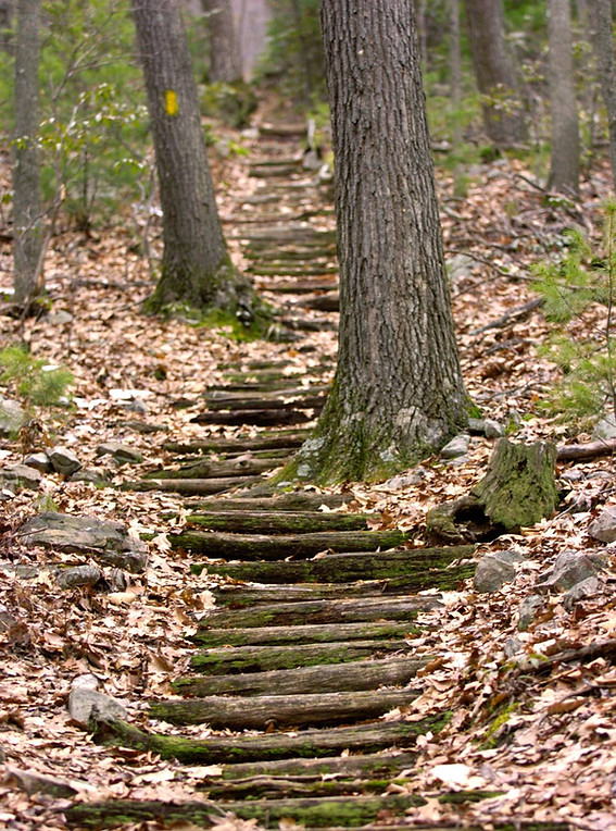
Indian Steps Trail to Campbell Trail
Campbell Trail crossing Harry Valley Road and unto Lowry Trail
Section 6: AS6 Indian Steps to "Doing Hard Time" - Mile 36.2 to 51.0
15.8 miles | 2466 feet climb; 1,587 feet decline
15.0 miles of singletrack or doubletrack; 0.8 miles of state forest road.
After down Harry Valley Road for 0.4 miles, runners face the Indian Steps—a brutal 500-ft climb straight up the ridge. At the top, they turn right onto the Mid State Trail (MST) before descending south on Campbell Trail (right turn) to Harry’s Valley Road.
From here, the course follows Lowry Trail, a snowmobile track that continues downhill along Tussey Ridge, crossing PA 26 and then paralleling the highway to Pine Swamp Road. Somewhere along this section, a course marshal will check runners in—no shortcuts allowed!
At Pine Swamp Road, runners head uphill via Ironstone Trail and turn left to rejoin the MST. The course climbs southbound on the MST toward Jo Hays Vista Truck Pull-off. Once there, runners keep the woods on their right, passing through a gate onto Jackson Trail, where a water-only aid station (AS7 Jackson Trail) helps fuel the next long section.
Now comes the real test—Jackson Trail. Traversing rocky ridges and boulder fields past David’s Vista, this stretch is sure to make runners question their life choices. We’ll even mark it with extra flagging ribbon—so you can curse it properly. Some sections names here: The Happy Hamster, The Fluffy Kitty and the Cuddly Teddy Bear.
After 2.6 miles of pure Jackson Trail suffering, the MST rejoins the course. From here, it’s another 4.25 miles of technical singletrack, crossing Laurel Run Road and Little Flat Fire Tower Road before reaching AS8 Little Flat.
This entire segment is nothing short of punishing:
-
Musser Gap Vista to Sand Spring Trail → 🎯 "Technical Difficulties"
-
Sand Spring Trail to AS8 Little Flat → 💀 "Hard Times"
History: The Battle of Indian Steps
For centuries, tribes fought for control of this region, with power shifting about every 50 years. But everything changed in 1635, when the Lenni-Lenape invaded Susquehannock territory and were brutally defeated at the Battle of the Indian Steps or aka The Great Battle of the Lenni Lenape-Susquehannocks War of 1635 near Rock Springs in Spruce Creek Valley.
Some accounts claim that more lives were lost here than at Gettysburg, though historians continue to debate the scale of the battle. Following their defeat, the Lenni-Lenape were forced eastward to the Delaware River Valley and modern-day New Jersey, where they soon encountered new invaders—European settlers.
The Birth of Rothrock State Forest: A Conservation Legacy
Rothrock State Forest exists today because of the massive deforestation of Pennsylvania in the mid-to-late 19th century. As lumber and iron companies stripped the land, leaving nothing behind, conservationists like Dr. Joseph Rothrock feared the forests would never recover without proper management.
Determined to protect Pennsylvania’s natural resources, Rothrock became the state’s first forestry commissioner in 1895, leading efforts to restore and manage the land. His work laid the foundation for modern conservation.
In 1897, the Pennsylvania General Assembly passed legislation allowing the state to purchase and protect "unseated lands for forest reservations." This law marked the birth of Pennsylvania’s State Forest system, ensuring that once-devastated landscapes could regrow and thrive for future generations.
Today, Rothrock State Forest stands as a testament to those early conservation efforts, offering rugged trails, diverse ecosystems, and a wild, untamed beauty that runners experience firsthand.

Indian Wells Vista offers some of the most tremendous and remote views in Central Pennsylvania. This view will be over your left shoulder and most mid-pack runners will arrive here at dawn.
Section 7: AS8 Little Flat Tower to AS9 Alan Seeger: Sunrises, Snakes and an Ancient Forest - Mile 51.0 to 58.6
7.4 miles | 325 feet climb; 1692 feet decline
7.4 miles of singletrack
AS8: Little Flat Fire Tower sits at the northernmost corner of Tussey Mountain, where the Mid State Trail (MST) arcs from northeast to south and west, winding atop Fourth Mountain and encircling the vast, bowl-shaped valley of Bear Meadows.
The trail stays high above the valley, offering technical terrain, boulder field traverses, and breathtaking vistas just off to your left. Many runners will see the sunrise on their left—which may feel strange, considering the sunset was also on your left the night before. Wait—what? I know, right? Welcome to running a ridgeline!
One of the race’s biggest visual rewards awaits: Indian Wells Vista. This spectacular overlook offers a rare, untouched wilderness view—no houses, no streetlights, no civilization. Just pure, unspoiled beauty stretching as far as the eye can see.
At mile 54.2 is the corner of Gettis Ridge and North Meadows Roads, before the course turns east along Thickhead Mountain on the southern rim of Bear Meadows. A water stop will be here at Bear Meadows Road (Mile 55.7) in the Thickhead Mountain Natural Area. From here, runners descend—and not just any descent—the longest downhill of the race, crossing Bear Meadows Road and Detwiler Road before reaching the junction of the Mid State Trail and the Standing Stone Trail (SST).
Now, the course follows the SST southbound, running alongside Detwiler Run and atop remnants of an old logging railroad: The Monroe Kulp Railway.
One of our race team members once said:
"Running through Detwiler Run is like running through Jurassic Park—you half expect a dinosaur to step onto the trail."
Personally, I’ve never seen a dinosaur. But I did see here the biggest rattlesnake of my entire life.
Fair warning: There is a 99.9% chance you’ll see a snake. Maybe a snake. Maybe snakes. Maybe a rhumba of snakes (yes, that’s the actual term for a group of rattlers). Maybe even a full-on pile of snakes somewhere on this course. Consider yourself warned.
The next aid station comes immediately after Alan Seeger Natural Area, one of only 20 old-growth forests left in Pennsylvania. This 390-acre ancient woodland along Standing Stone Creek is home to towering white pines and hemlocks, spared by loggers at the end of the 19th century.
As you weave through 20-foot-high rhododendrons, look up—the ancient hemlocks still stand, watching over the trail. This cathedral-like forest is named after Alan Seeger, an American war poet who fought and died in World War I at the Battle of the Somme. Sometimes called the "American Rupert Brooke," Seeger is best known for his haunting poem, "I Have a Rendezvous with Death."

Alan Seeger Natural Area is one of only 20 old growth forests in Pennsylvania. Along Standing Stone Creek, includes virgin white pine and hemlock tree and 20-foot-high rhododendrons.
History: The Birth of the Mid State Trail
In 1966, Dr. Boone Sumantri envisioned a ridge-top hiking trail called the Central Allegheny Trail, sketching a rough route from Colerain Picnic Area (PA Route 45) to a roadside rest stop on US 15 near Williamsport. The plan was to eventually connect it to the Loyalsock Trail.
On a sunny Sunday in September 1969, Dr. Thomas Thwaites and 15 members of the Penn State Outing Club climbed to Little Flat, just south of State College. With trailblazing tools in hand, they carved out the first stretch of the Mid State Trail, starting from Kettle Trail to North Meadows Trail.
Following the ridgeline of Fourth Mountain, this pioneering crew opened the first scenic view of the MST—a breathtaking overlook above Bear Meadows. Today, a monument stands at the site of this first blazed section, marking the origins of what would become Pennsylvania’s wildest and most rugged long trail.

At the top of Broad Mountain is the second of two fire towers you will cross during the race. Its location is significant since at mile 60, you have 3.5 miles of downhill running to the finish.
Section 8: "Mount Quads" & The Finish at Greenwood Furance - Mile 58.6 to 63.5
5.4 miles | 1374 feet climb; 1407 feet decline
5.1 miles of singletrack; 0.2 miles paved
The final section is a brutal yet fitting climax, as runners tackle one of the steepest climbs of the race—the ascent up Broad Mountain via the Standing Stone Trail. This beast climbs 1,400 feet to the summit before dropping 1,400 feet down the other side, crossing Seeger Road twice—once before the summit, once after.
We affectionately call this "Mount Quads" for a reason. Your legs will know why.
At Greenwood Furnace State Park, the course cuts straight across a park service road, then down a park access road into an elongated traffic oval and around to the finish at the Wagon & Blacksmith Shop—
🏁 Congratulations on your epic finish! 🏁


After purchasing the Freedom Iron Works in nearby Burnham in 1833, Norris, Rawle and Company needed a steady supply of iron. A suitable location with iron ore, limestone, water, and trees was found here so they built Greenwood Furnace, which went into blast on June 5, 1834. The charcoal-fueled furnace produced about four tons of pig iron ingots per day with an annual output of around 1,200 tons. The iron was hauled by wagons over Stone Mountain to Freedom Iron Works to be turned into wrought iron.
History: Greenwood Furnace & the Birth of an Industry
On June 5, 1834, Greenwood Furnace roared to life, fueled by iron ore, limestone, endless forests for charcoal, and a steady water supply. Its parent company, Norris, Rawle & Co., built the furnace in this remote valley for its rich natural resources, and at peak production, it churned out five tons of pig iron per day.
A company town quickly sprang up around the furnace, complete with 20 houses, a company store, stables, and a blacksmith shop. When a high-quality iron ore deposit was discovered nearby, the operation expanded even further. In 1842, a gristmill was built, powered by water from the newly constructed Greenwood Lake, which remains a recreational gem in the park today.
In 1847, John A. Wright—one of the founders of the Pennsylvania Railroad—took over Greenwood Furnace Iron Works. The iron produced here helped fuel the railroads and industrial boom of the region. One of the men overseeing the ironworks? A young Andrew Carnegie, whose experiences here would help shape the future steel empire that built America.

Fishermen gather at Greenwood Furnace Lake. The lake offers a beach and a shower house for Ironstone participants after the race. (Image: Rusty Glessner, PA Bucket List)


The Eastern States Trail-Endurance Alliance promotes trailrunning and the responsible use of public lands, through events such as the Eastern States 100, Ironstone 100K and Eagleton Trail Challenge, three footraces we manage as a stewardship for trailrunners and the community.